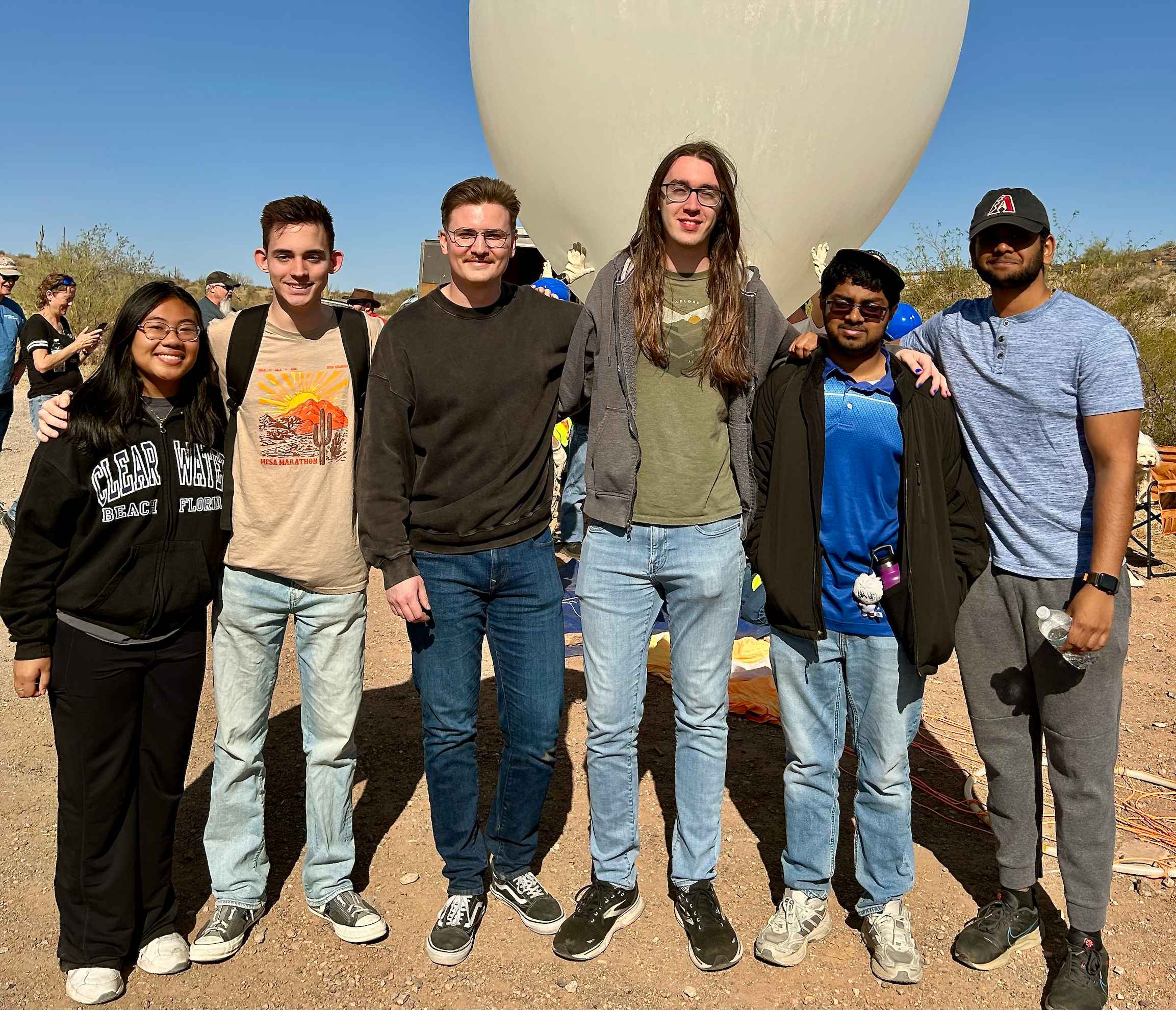
Software Launch Team
A group photo of the StratoDevils software team, including myself, taken just before the payload launch.
As a member of the Sun Devil Satellite Laboratory (SDSL) at Arizona State University’s Fulton School, I have had the opportunity to work on ASCEND—a comprehensive aerospace program that embodies the full design–build–fly–operate–analyze cycle of a space mission. ASCEND (Aerospace Scholarships to Challenge and Educate New Discoverers) is an Arizona Space Grant Consortium Workforce Development initiative that brings together undergraduate teams from across Arizona.
We are the StratoDevils, a team consisting of multidisciplinary undergraduates broken into mechanical, electrical, software, and telemetry subteams. Our goal is to design and build a payload that will be lifted by a high-altitude weather balloon to altitudes in excess of 100,000 feet. This hands-on project not only challenges us to integrate imaging and tracking technologies with atmospheric and thermal experiments but also prepares us for real-world aerospace research and development. The culmination of our data analysis is then presented at major events like the NASA Undergraduate Research Symposium annually.
As the Deputy Software Lead, my responsibilities span project management, team coordination, and hands-on development. I guide a team of 10 members, focusing on using Agile methodologies to navigate the complexities of software development. Through week-long sprints managed via Jira and extensive use of Git and GitHub for collaborative coding, our team develops robust software primarily in C++ and Python, crucial for both flight operations and data analysis.
ASCEND is a collaborative initiative involving several key organizations. The Sun Devil Satellite Laboratory (SDSL) at ASU spearheads the project, providing the leadership and technical expertise necessary to design and develop the payload. The initiative is part of the Arizona Space Grant program, which is funded by NASA, highlighting the significant role that NASA plays in supporting space-focused education and research. Additionally, the ANSR team is instrumental in coordinating the launch operations, ensuring that our payloads are successfully integrated with the high-altitude weather balloons. Together, these organizations—SDSL, NASA Arizona State University, Arizona Space Grant, and ANSR—make this project possible.





In my role as Deputy Software Lead, I co-manage the Software Team consisting of 10 members alongside the Software Lead. Together, we oversee the development of flight software, ground software, and data processing systems. I implemented industry-relevant practices and fostered a fast-paced, quality-driven environment by adopting Agile methodologies.
To address previous project challenges, I spearheaded the adoption of Jira and Scrum management. I broke down our work into one-week sprints, each culminating in a retrospective. As Scrum Master, I managed our project board, identified bottlenecks, coached team members, and leveraged Jira metrics to drive continuous process improvements.
I organized our software team into three specialized subteams—flight software (FSW), ground software (GSW), and data processing—while actively contributing to each area. My hands-on approach not only advanced the development efforts but also fostered strong inter-team communication, ensuring seamless integration of all software components.
Beyond my project management and leadership roles, I have been actively involved in the design and development of the payload’s flight software, primarily written in C++. Working with a dedicated four-member team, we focus on critical functions such as payload bootup, data collection, storage, and transmission during flight.
A key enhancement I led was transitioning from CSV-based data handling (used in Fall 2024) to a more efficient packet-based system. This upgrade significantly improves data storage efficiency and minimizes data loss. I enhanced several scientific sensors (e.g., BME680, MTK33339) to support packet formatting and updated our flash memory protocols to ensure reliable data writes and reads.
Special emphasis was placed on optimizing the onboard W25Q128 SPI flash memory. Building on my initial experience integrating flash into the payload in Fall 2024, I advanced its development by designing an onboard file system to effectively manage and distinguish different types of flight data. Additionally, I introduced payload commands, such as DELETE, DOWNLOAD, and STATUS, to improve communication with the ground software (GSW) and provided ongoing mentorship to the FSW team to maintain steady progress.
In parallel with my FSW contributions, I have been actively involved in the development of the ground software, primarily written in Python. Our four-member GSW team focuses on ensuring smooth communication between the ground station and the payload, handling data reception, processing, and routing.
We developed a multi-threaded pipeline system that breaks the ground software into serial input, serial sorter, and packet decoder modules, ensuring the system can keep pace with data demands. I was responsible for developing the packet decoder module, which dissects each packet to extract validation bytes (e.g., sync bytes, checksum) and converts scientific sensor data into CSV format for subsequent routing to 3D and 2D data processing.
The ground software is still under development as we work towards interfacing GSW with payload commands and shifting from a serial interface to an intuitive GUI for improved controls.
In addition to my contributions to FSW and GSW, I played a key role in enhancing our data processing efforts. Our three-member Data Processing team focuses on converting post-flight data into useful visualizations that drive scientific understanding.
Most notably, I developed the software that bridged the gap between raw data and its visualization. Drawing on my experience with CesiumJS from my SatComm Optimizer project, I used JavaScript, HTML, and CSS to animate the payload’s movements using longitude, latitude, and height data derived from Fall 2024’s launch. To provide an interactive and precise model for data analysis, I incorporated timestamps for each flight data point, ensuring the animation accurately reflects real-time flight intervals. To streamline the process, I developed a Python-based data parser that converts raw GPS data into a Cesium-readable JSON format.
This framework is still a work in progress as we aim to improve its scientific capabilities—such as displaying atmospheric layers and calculating real-time speed. I am leading our data processing team as we evolve these visualizations toward the goal of displaying live data during the payload’s ascent and descent.
Below, you will find a collection of photos from my various experiences while working on the ASCEND project for Spring 2025.

A group photo of the StratoDevils software team, including myself, taken just before the payload launch.
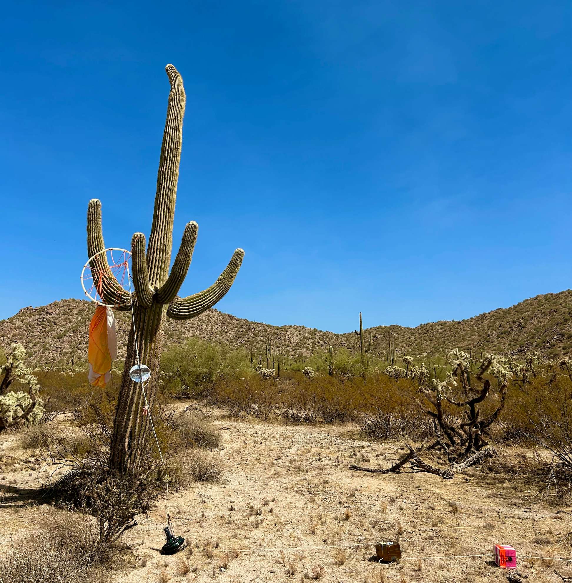
An image of the payload’s landing site, with the parachute tangled around a saguaro cactus in the Arizona desert.
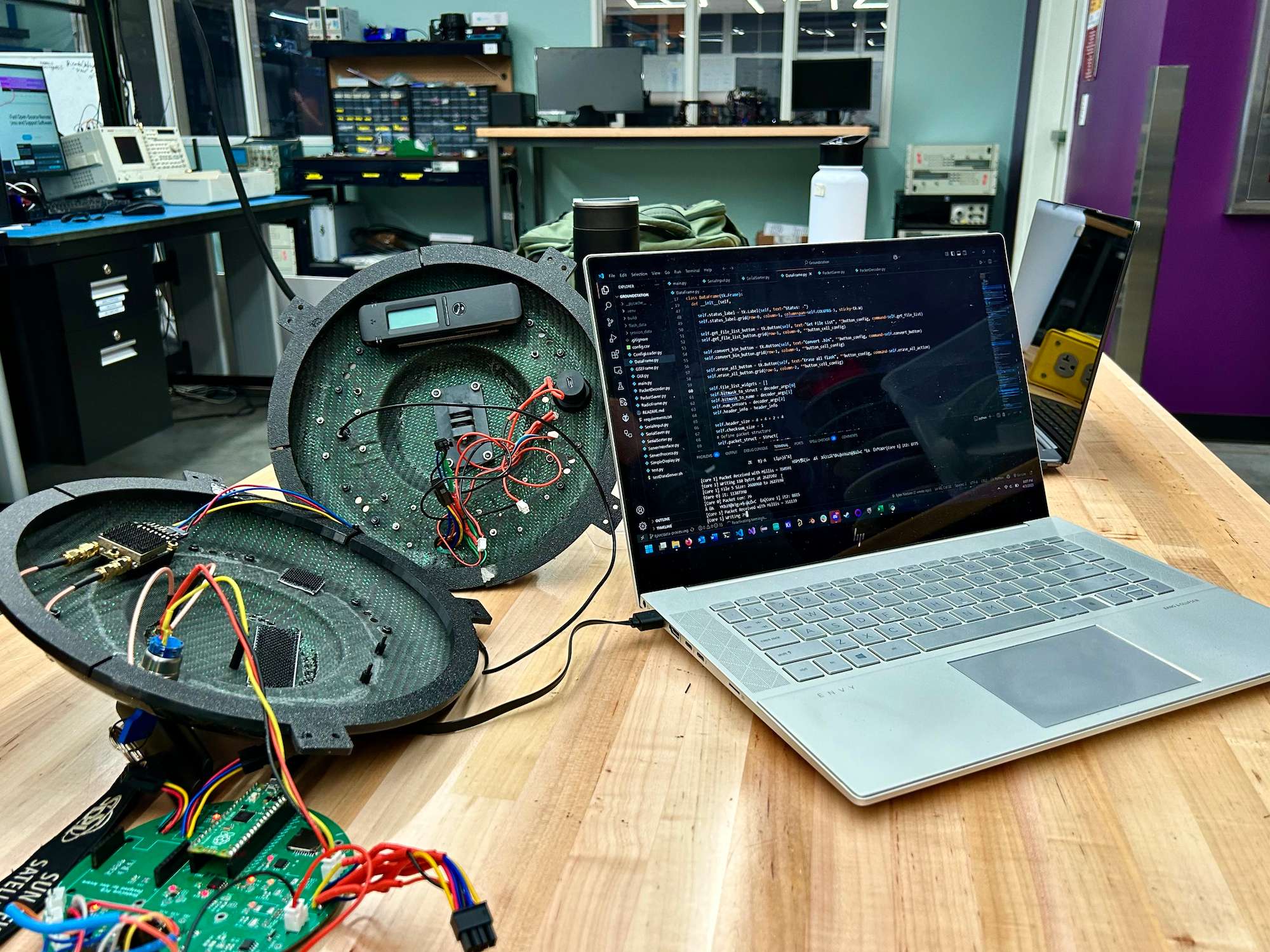
A photo of the software team retrieving onboard flight data from flash memory after the launch.
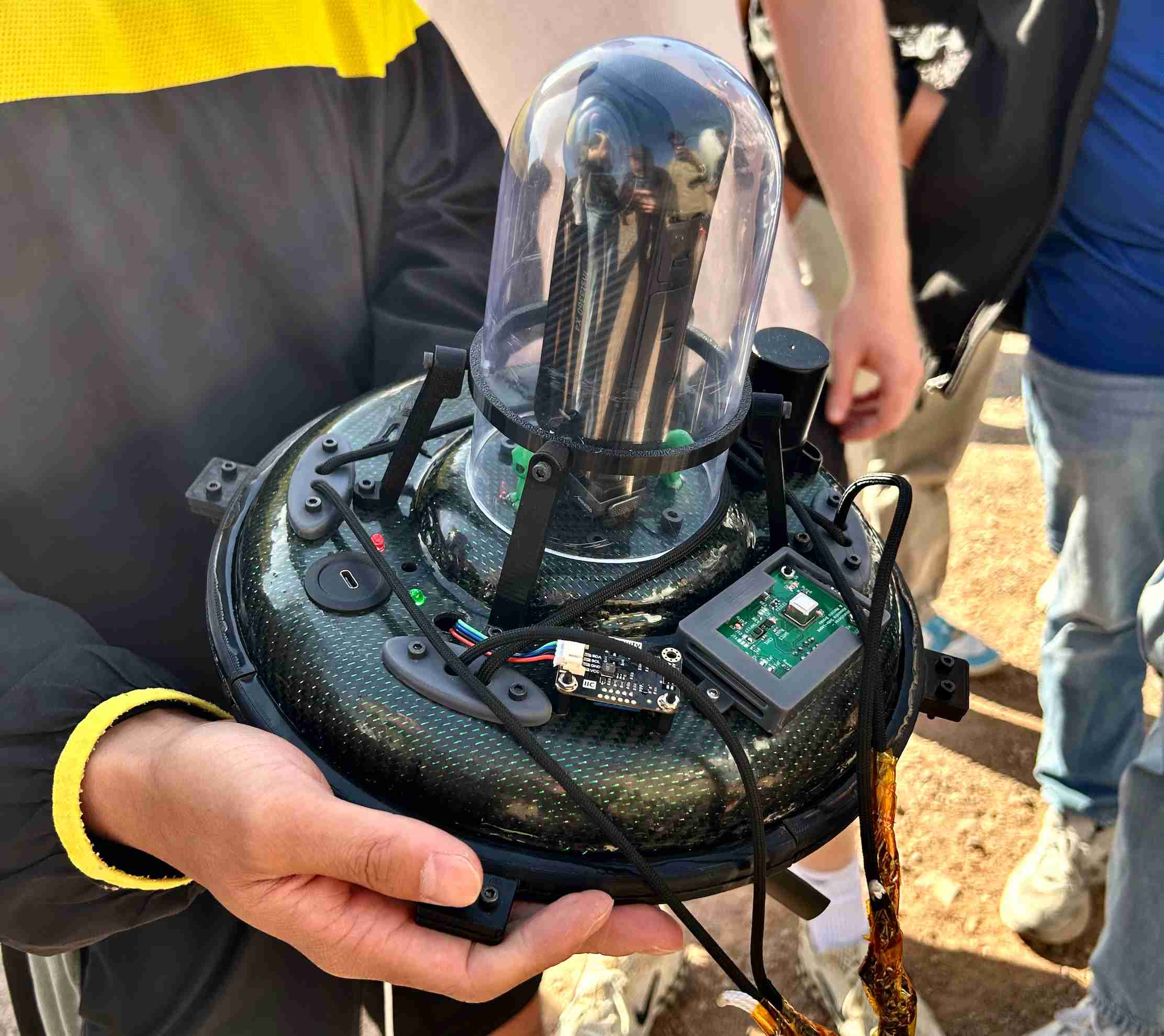
An image of the final stacked payload secured to the weather balloon, moments before launch.
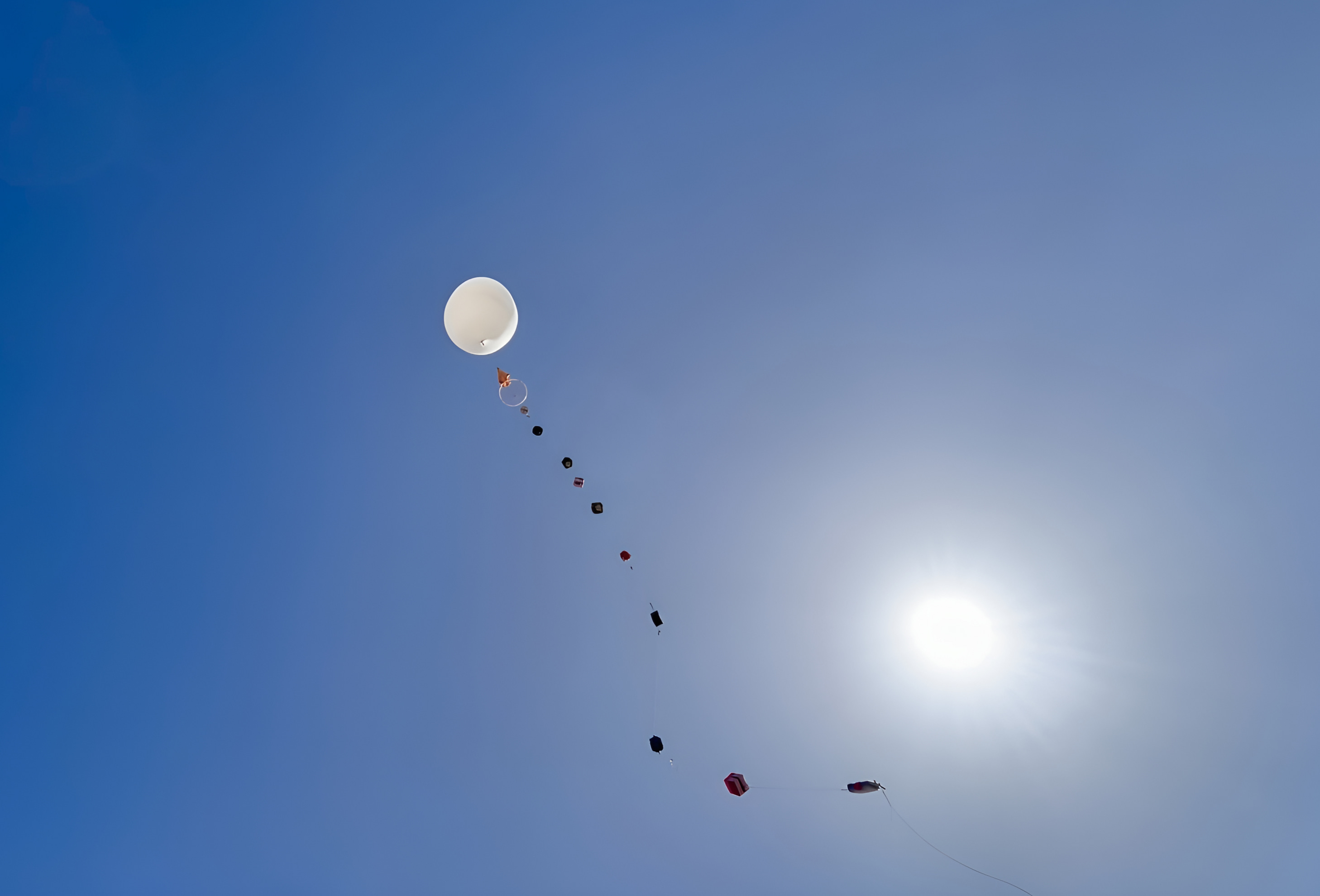
A photo of the ASCEND weather balloon carrying the ASU StratoDevil payload alongside those from other university teams.
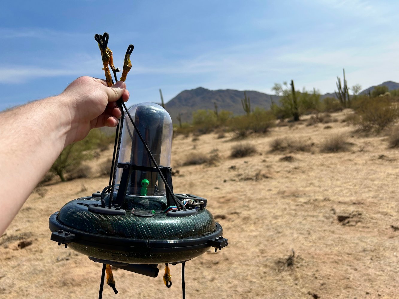
A photo of the recovered payload after landing in the Sonoran Desert near Eloy, Arizona.
In Fall 2024, I began my journey with ASCEND as a member of the Software Team. I was highly proactive—frequently mentoring peers and even hosting my own office hours to facilitate progress. Recognized for these efforts, I was quickly promoted to Deputy Software Lead, where I co-managed a 6-member team alongside the Software Lead. In this role, I focused on fostering clear communication among team members, ensuring everyone was aligned with project requirements and tasks. Additionally, I remained actively involved in software development, using my hands-on experience to guide and mentor the team.
Beyond my leadership responsibilities, I played a key role in advancing the flight software onboard the payload. Most notably, I refactored the ASCEND legacy codebase to a modular, object-oriented design in C++, which allowed for seamless integration of new hardware and sensor interfaces (e.g., INA260, SGP30) and supported faster communication protocols like I2C and SPI. Moreover, I was responsible for incorporating the W25Q128 SPI flash memory onto the payload, establishing a more reliable storage solution compared to SD cards. I developed the foundational software that ensures data is read and written reliably, effectively preventing overwrites and data corruption.
Below, you will find a collection of photos from my various experiences while working on the ASCEND project for Fall 2024.
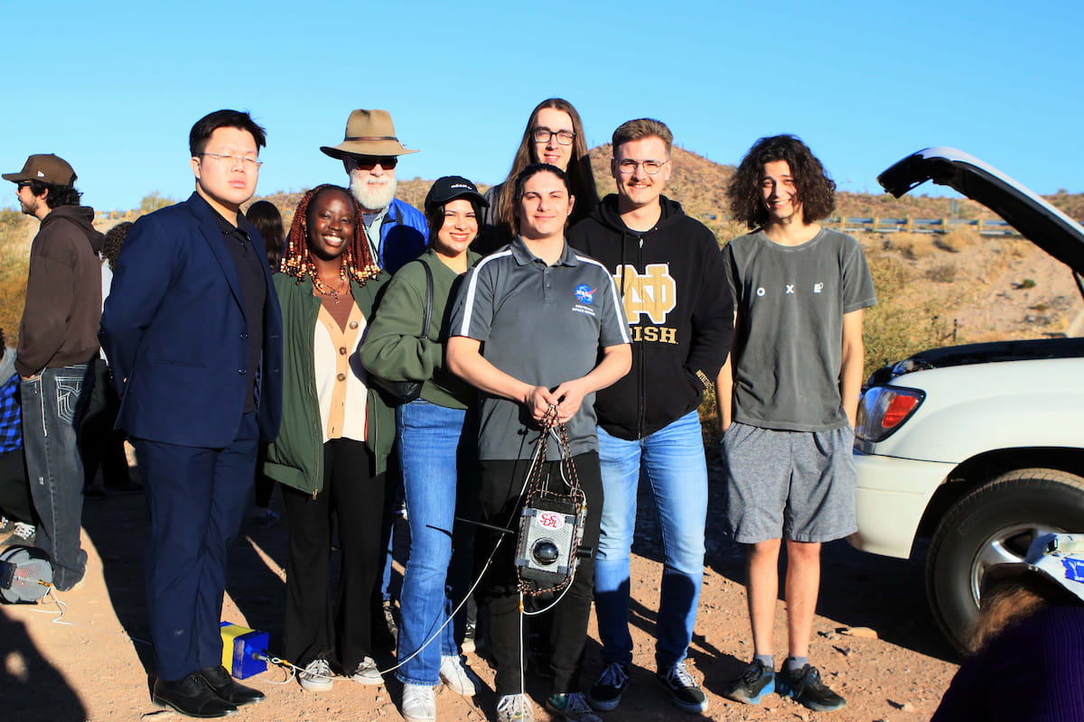
A group photo of the StratoDevils launch team, including myself, before the payload launch.
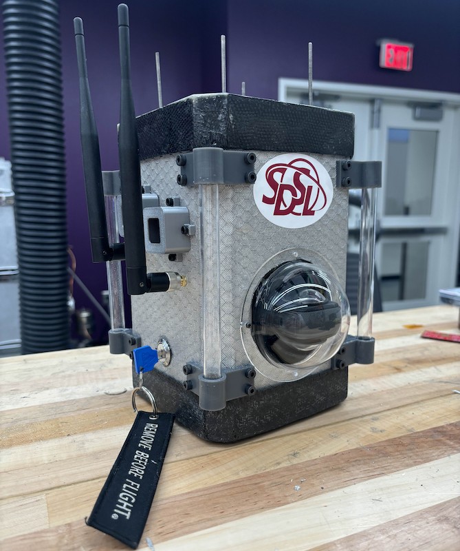
An image of the fully stacked payload, ready for launch.
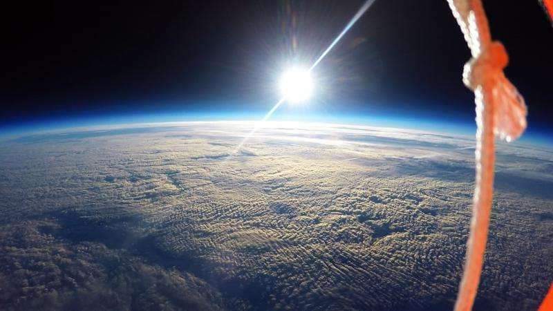
A photo captured by the payload, showcasing Earth's curvature from an altitude exceeding 100,000 feet.
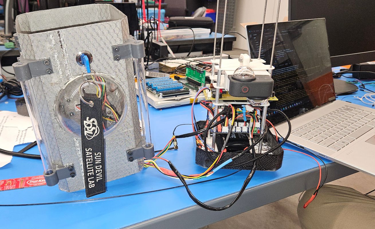
An image of the partially assembled payload undergoing final software tests prior to complete assembly and launch.
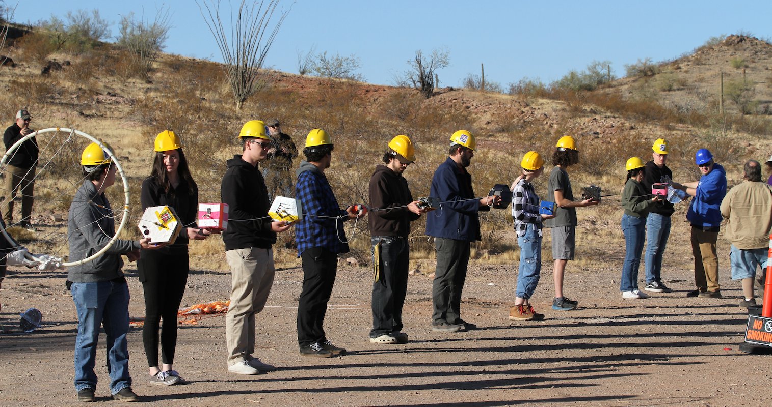
This photo captures the moment just before launch—team members from each school hold their payloads, ready to sprint as the weather balloon ascends.
(I am pictured at the back, representing the ASU StratoDevils)
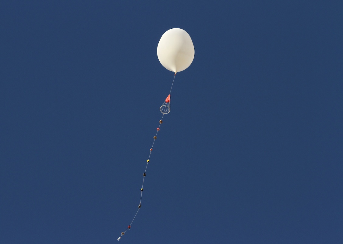
A photo of the ASCEND weather balloon carrying the ASU StratoDevil payload alongside other team payloads.
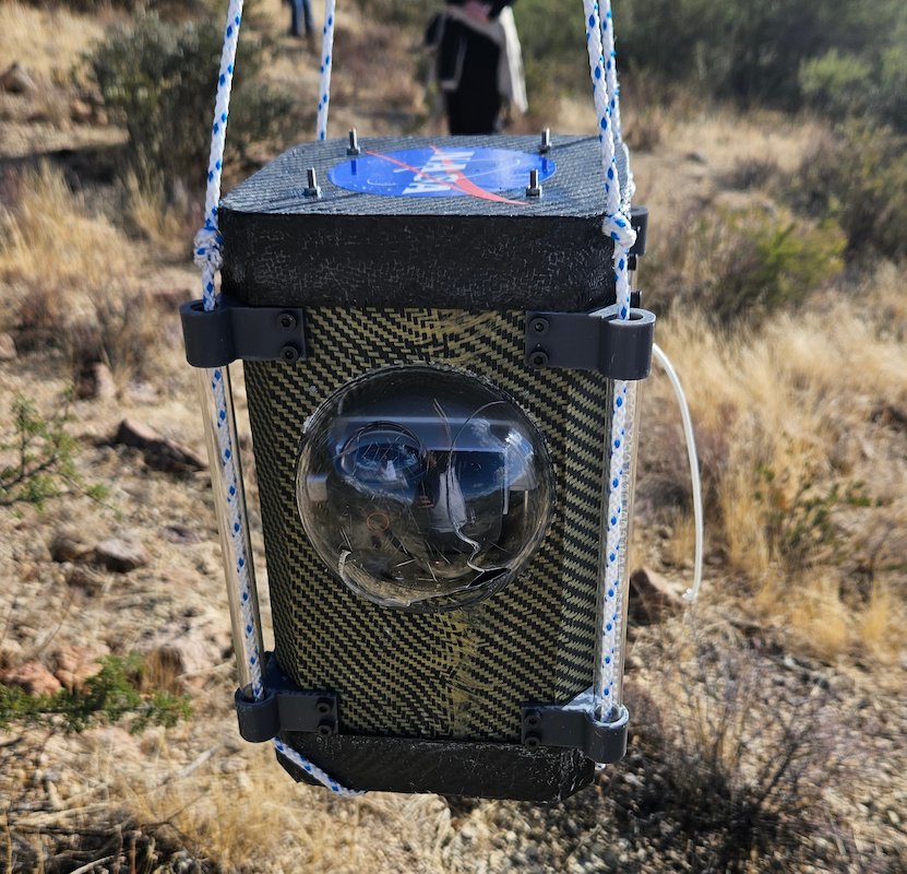
An image of the StratoDevil payload following its descent from over 100,000 feet.